
3D Spatial Modelling Services for Architecture, Real Estate, Industrial & Urban Planning
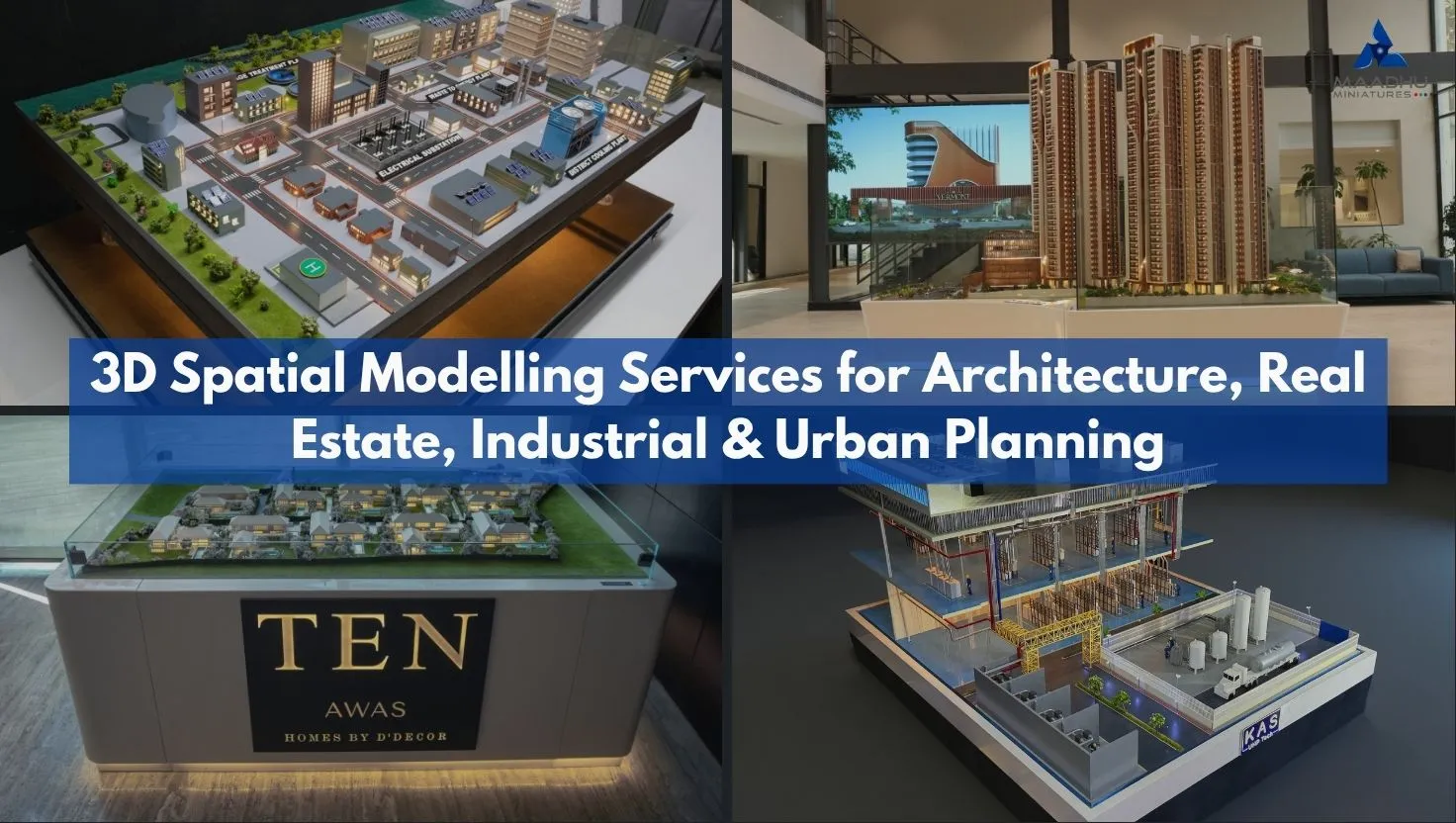
You can make your ideas real with 3D Spatial Modelling Services. These services are very useful for architects, engineers, developers, real estate professionals and urban planners. They can see what their projects will look like before they even start building. This is beneficial for them to improve their planning and decision-making processes. This helps them plan better, avoid mistakes and make decisions.
3D spatial modeling allows us to create 3D models of buildings, factories, roads, real estate projects and city plans. This helps the people working on the project understand everything clearly. They can work together better. Save time and money.
At Maadhu Creatives we give you Spatial Modelling Services that fit your project needs. We use the technology and our experience in the field to make high-quality digital models. These models help turn your ideas into projects that are well planned. We use 3D Spatial Modelling Services to make this happen. Our 3D Spatial Modelling Services are very good, at helping you visualize your projects.
What Are 3D Spatial Modelling Services?
3D Spatial Modelling Services are about creating pictures of places and things such as buildings and roads in three dimensions. These pictures are very accurate. Have a lot of information, about the space so people can view them from all sides.
Nowadays making these spatial models involves using lots of tools like special computer programs for designing things, mapping systems and even drones and lasers to get really precise information. 3D Spatial Modelling Services take all this information. Put it together into one big digital picture that helps people plan, analyze, build take care of and even think about what to do with a place, in the future.
These digital models can represent:
Residential and commercial buildings
Industrial plants and manufacturing facilities
Infrastructure projects
Smart city developments
Urban master plans
Transportation networks
Landscapes and terrain
Utility systems
Real estate developments
By combining accurate measurements with realistic visualization, organizations can identify design issues early, improve coordination between teams, and reduce costly modifications during construction.
Why 3D Spatial Modelling Is Important
Modern projects involve different people who are involved in the work, including architects, structural engineers, contractors, developers, investors and government authorities. Sharing technical information using only drawings is often challenging.
3D spatial modelling creates a representation of data in the form of models yielding real-life structures. This provides ease in illustrating and understanding data.
Some aspects of 3D spatial modelling are:
Improved Visualization of Projects
3D digital models allow for the simulation of a completed project. This gives the client and stakeholders the ability to see the project before construction. Additionally, this improves the decision-making process and reduces the likelihood of miscommunication.
Improved Design Accuracy
When we use CAD modelling services and engineering data we can reduce mistakes in the design. This also helps the project team work together smoothly.
Faster Planning
Digital models help us get approvals. Have planning discussions quickly. We can also review designs. Give presentations to clients faster.
Reduced Project Risks
We can use models to find potential problems, between architecture, structure, utilities and engineering systems early on. This saves us time and money.
Enhanced Collaboration
Architects, engineers, contractors and clients can all work together using the digital model. This helps everyone communicate clearly throughout the project. 3D spatial modelling really helps with this because it gives everyone an understanding of the project.
How Architects Use 3D Spatial Modelling Services
Architecture is one of the largest industries benefiting from 3D Spatial Modelling Services. For every step of the project (from the initial design concept to finished construction documents), appropriate digital modeling brings efficiency to the process.
Architectural Design Visualization
Using digital 3D architecture models, architects can create realistic images that show the clients the various aspects of the design (i.e., the layout, materials, lighting, landscaping, overall design, and style, etc.) before any actual construction.
Design Development
Architects can evaluate design alternatives with digital models and design in a way that maintains the required dimensions. This allows for changes in the design to be made quickly and without the need to redraw the plans.
Construction Planning
With accurate 3D construction models, contractors can plan better for the construction sequencing, identify issues that can be worked on to improve the execution of the plan, and model construction more effectively.
Client Presentations
Presenting an accurate 3D model of the construction design will create a more immersive and realistic experience for the clients and will lead to faster and more confident decisions.
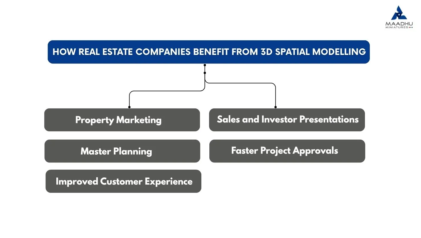
How Real Estate Companies Benefit from 3D Spatial Modelling
The real estate industry depends heavily on visualization. Buyers, investors, and developers prefer seeing projects before construction is completed.
Real estate modelling is really useful because it helps people understand properties better.
Property Marketing
Developers use real estate 3D modelling to show people what apartments and buildings will look like. They make digital pictures of residential apartments, commercial buildings, villas, and townships.
Sales and Investor Presentations
When investors look at models, they can see how the project will be laid out. They can see the amenities and the infrastructure and what the landscaping will look like. They can even see what the area will be like in the future.
Master Planning
When you are planning a community, you need to think about the roads and the parks and the utilities. You also need to think about parking and public infrastructure. Spatial modelling helps planners use the land in the most possible way.
Faster Project Approvals
Government agencies can look at models of proposed developments. This helps them understand the projects better and make decisions faster.
Improved Customer Experience
When people can see what a property will look like they feel more confident. They can look at digital pictures of future developments and this helps them decide to buy. Real estate modelling is really good, for sales. Real estate modelling helps people understand properties better.
Technologies Behind Modern 3D Spatial Modelling
Advanced 3D Spatial Modelling Services combine multiple technologies to produce highly accurate digital environments.
Some technologies that people often utilize include:
CAD modeling services, which allow for the preparation of engineering drawings and detailed designs for projects.
GIS mapping services, which help in linking spatial data together for a clearer picture.
You can also use Point Cloud to convert to 3D Model with laser scanning.
3D Visualization Services which provide an opportunity to make project presentations look realistic.
Topographic Modelling which allows for better analysis of the landscape and development of land.
Digital Engineering processes facilitate teamwork among various parties.
With the use of Virtual Construction methods, one can see what the process of building a project will look like beforehand.
By using these technologies like CAD Modelling Services can be more accurate plan better and make decisions at every stage of the project from start, to finish.
3D Spatial Modelling for Industrial & Engineering Projects
In order for industrial and engineering operations to function properly, accuracy and effective planning processes are necessary. Today, the demand for increased cooperation among the participants involved in completing a project and minimizing mistakes can serve as a basis for the application of 3D Spatial Modelling Services.
From production sites and oil refineries to power-generation stations, industrial modeling implements precise digital representations of facilities. Engineers can evaluate the location of equipment as well as production flow, access for maintenance and safety clearances before the installation process begins.
Plant Design and Equipment Layout
Industrial facilities are interconnected by pipelines, machinery as well as electrical systems and structural elements. Engineers using engineering models can optimize layouts for equipment and maximize space and increase the efficiency of operations.
Infrastructure Planning
Large-scale infrastructure projects, such as bridges, highways, airports, railway stations, ports industrial parks, and airports benefit from 3D modeling of construction. Engineers can spot problems with design in the early stages, thus reducing delays and costly modifications in the course of construction.
Engineering Visualization
Advanced engineering visualization can help those involved in the project understand the technical aspects of their projects through authentic digital presentations. This facilitates communication between contractors, engineers customers, investors, and clients.
Facility Management
After the project is completed Digital models continue to be valuable in support of maintenance plans as well as maintenance management, equipment upgrades and expansions in the future.
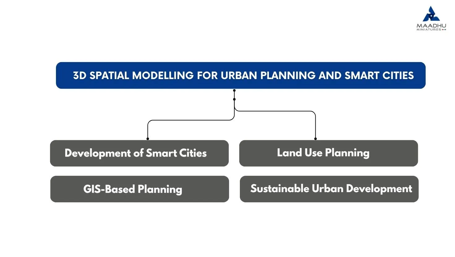
3D Spatial Modelling for Urban Planning and Smart Cities
As cities continue to expand, governments and planners require accurate digital tools to design sustainable and efficient urban environments. 3D Spatial Modelling Services have become an essential part of modern smart city planning.
Urban planners use digital models to analyze transportation systems, public infrastructure, zoning regulations, utilities, environmental impact, and future development opportunities.
Development of Smart Cities
The development of contemporary smart cities involves the use of data in digital format to enhance planning and governance. The use of 3D modeling of urban planning helps the authorities assess traffic management, transportation, green areas, drainage, and utilities.
Land Use Planning
Precise topographical modeling assists in assessing terrain conditions, drainage, and other environmental factors. This helps in maximizing the use of land and minimizing the impact on the environment.
GIS-Based Planning
The integration of GIS mapping services and 3D spatial modeling helps in gaining full insight into geographical information. Planners are able to analyze the population density, infrastructure, flood plains, transport corridors, and urban growth.
Sustainable Urban Development
Digital modeling helps in planning communities that are sustainable and eco-friendly.
Benefits of Choosing Professional 3D Spatial Modelling Services
Partnering with an experienced 3D modelling services provider offers significant advantages across every project stage.
Key benefits include:
Improved design accuracy and visualization
Better collaboration among architects, engineers, and contractors
Faster project approvals and client presentations
Reduced construction risks and rework
Optimized land utilization and infrastructure planning
More efficient facility management
Enhanced decision-making using real-time digital information
Cost savings through early clash detection and planning
Better communication with investors and stakeholders
Scalable solutions for projects of every size
Whether the project involves architecture, engineering, industrial development, or urban planning, professional modelling services help achieve higher quality outcomes while minimizing project risks.
Why Choose Maadhu Creatives for 3D Spatial Modelling Services?
Maadhu Creatives uses all three aspects of creativity, engineering, and digital technology to offer 3D spatial modeling services that are highly advanced and are tailored to suit the requirements of each individual customer.
We collaborate with architects, builders, engineers, industries, infrastructure consultants, and governmental agencies in order to bring their visions to life through accurate digital modeling services.
We offer:
Architectural 3D modelling
Industrial modelling solutions
Engineering modelling services
Real estate project visualization
Urban planning models
CAD modelling services
GIS mapping support
Digital engineering solutions
High-quality 3D visualization services
Every project is developed with precision, ensuring realistic visualization, technical accuracy, and seamless collaboration throughout the project lifecycle.
The Future of 3D Spatial Modelling
New technologies such as Artificial Intelligence, Digital Twin, cloud collaboration, drone surveying, and real-time visualization have transformed the future of 3D Spatial Modelling Services.
Organizations are realizing the importance of intelligent digital workflows, thereby helping improve project planning, design automation, monitoring of infrastructures, and promoting sustainable development.
Given that digital transformation has gained significant momentum momentum in architecture, engineering, construction, manufacturing, and urban development, spatial modeling remains a crucial technology in ensuring decisions are made smarter and projects delivered with ease.
Conclusion
The 3D spatial modeling services are changing the entire conceptualization and execution of projects in various industries such as real estate, urban planning, architecture, and industrial engineering. With the help of innovative technologies like laser scanning, digital twins, GIS, CAD, and advanced visualization techniques they create authentic digital models of the process or object enabling collaboration and effective decision-making.
Irrespective of whether you design a smart city, plan for the construction of a residence, or create a building for industrial purposes, investing in services of spatial modeling is likely going to bring a lot of benefits to your project.
Maadhu Creatives is a reliable company, which offers state-of-the-art 3D spatial modeling services of accurate and individual nature.
FAQs
What are 3D Spatial Modeling Services?
3D Spatial Modelling Services allows for the creation of accurate electronic representations of structures, infrastructure and industrial endeavor for the benefit of planning, designing and visualizing.
Who benefits from 3D Spatial Modelling Services?
The scope of the services is applicable in construction, architecture, real estate, engineering, industrial projects and urban planning.
Why is the use of 3D Spatial Modelling Services beneficial?
It improves visualizing the project, cuts down on design mistakes, saves money and time, and provides more effective solutions prior to the construction.
Can one create a 3D model of an already built building?
Yes, it is possible since there is laser scanning and point cloud technology that helps to turn any existing building into a 3D model.
Related Blogs

How to Start a Career in Model Making: Skills & Guide
Thinking about a career in model making? Explore the skills, training, tools, experience, and career opportunities needed to become a model maker.
Read More
maadhu creative
•March 15, 2025

How to Make Realistic Trees for Model Making: A Step-by-Step Guide
Create realistic trees for model making with simple materials, detailed branches, natural textures, and lifelike foliage for architectural and miniatu...
Read More
Maadhu Creatives
•April 05, 2025
Model Train Scales and Sizes: Choose the Right Scale for Your Layout
Model train scales and sizes explained from G to Z. Compare popular scales, understand their differences, and choose the right size for your layout.
Read More
Maadhu Creatives
•November 11, 2024
